


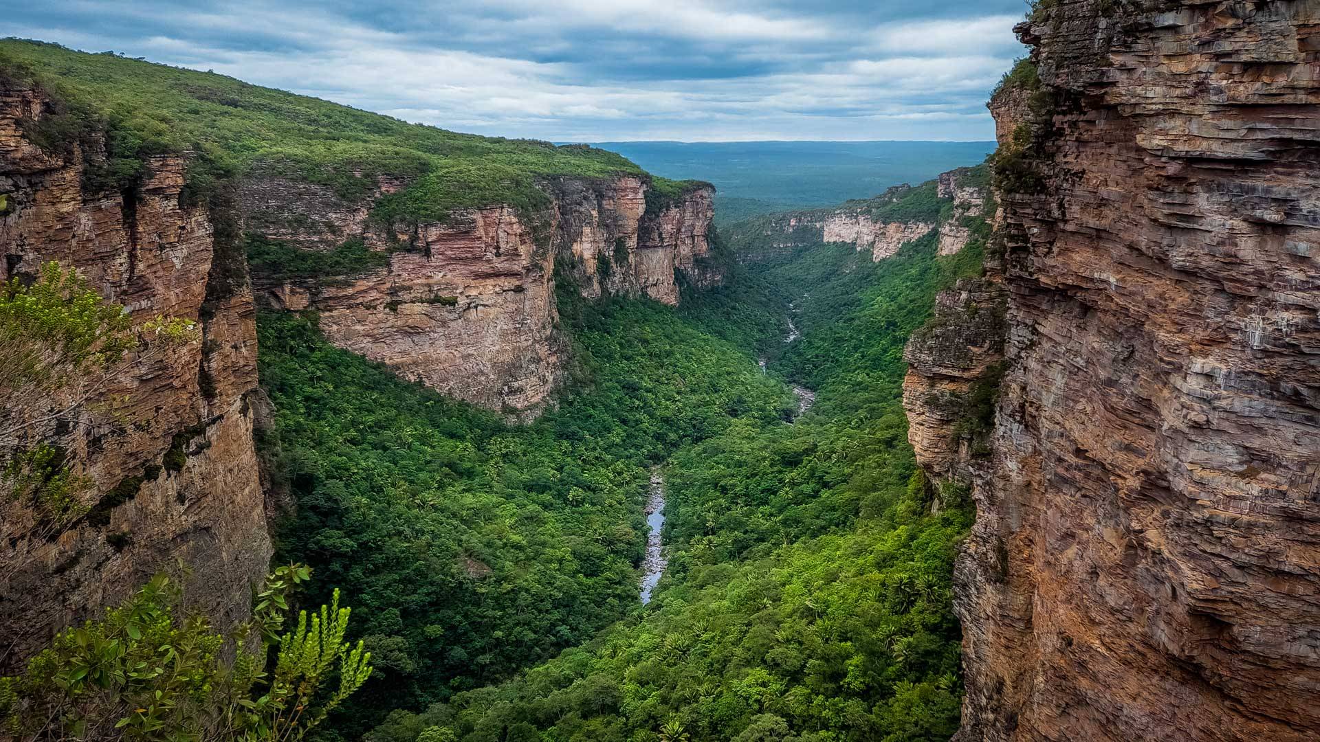
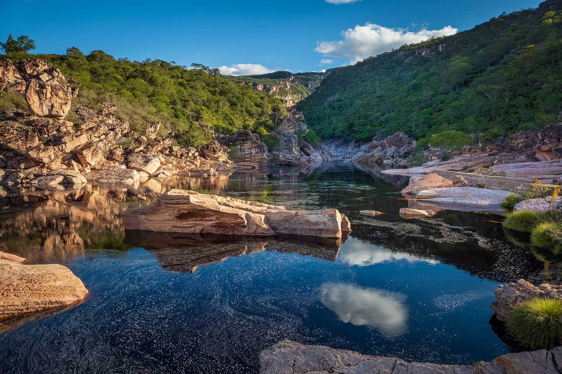
Framed by imposing rocky cliffs, the Encantada waterfall cascades down 283 meters (928 feet) until it reunites with the Samina riverbed. Sneaking through the canyon among rocks and trees, the waterway marks one of the borders of Chapada Diamantina National Park, in the State of Bahia, Brazil. To its north lies a fully protected area. To its south, a still unprotected territory. This place, known as Serra da Chapadinha, is like its neighbor in many ways — it houses threatened species, water reservoirs and an endless supply of scenic beauty. The mountain range, however, remains vulnerable to mining, real estate speculation, deforestation and hunting.
Ongoing mineral prospecting near rivers and springs has raised the alarm among locals, who are concerned about the region’s water supply. To ensure the range’s protection, the “Save Serra da Chapadinha” (originally “Salve a Serra da Chapadinha”) movement was created, setting off a race against time to establish a conservation unit, the official name that protected natural areas receive under Brazilian legislation.
The popular mobilization was taken up by state representative Hilton Coelho. At the end of May, he forwarded a recommendation (n° 26.650/23) to Governor Jerônimo Rodrigues to transform Serra da Chapadinha into a protected area. The document emphasizes the need for legislation that grants the “preservation and conservation of one of the most important water recharge areas responsible for the water supply of 80 municipalities, including the capital, in the State of Bahia.”
In early June, the proposal was approved by the majority of the Bahia Legislative Assembly (ALBA) Steering Committee.
“This was a fundamental step that the Bahian legislature took to express that there is an urgent need for state intervention to ensure the preservation and conservation of this environmental sanctuary, upon which many lives in Bahia depend,” celebrated the PSOL representative, adding that this movement doesn’t end in the Parliament. “We are spreading the local communities’ campaign in defense of Chapadinha with the support of members of PSOL in the Federal Chamber, public universities, entities and movements focused on the defense of water and the environment.”
An online petition for the creation of the conservation unit had already received more than 18,000 signatures at the completion of this article. On Instagram, the “Save Serra da Chapadinha” movement page has nearly 15,000 followers.
While the type of conservation unit to be established was not specified, those orchestrating the movement say they believe it should be a wildlife refuge, a category that grants integral protection and does not require the displacement of landowners, as long as they align their activities with the objectives of the protected area.
The proposal is currently being evaluated by the State Department of the Environment (Sema-BA). In a statement, Sema notes that it has already discussed the proposal with the governor and is “preparing for the possible establishment [of the conservation unit] that would culminate in the signing and publication of a decree. It’s not a quick process because it depends on studies, identification of conservation targets and of the best form of protection, along with consultations and public hearings to inform the entire population.”
According to Sema-BA, the process also requires technical and financial support to conduct the studies, which could come from universities, public agencies, research institutions and civil society organizations. “It’s estimated that the process could take up to three years,” declares Sema, also acknowledging the hydrological significance of Serra da Chapadinha and its scenic beauty.
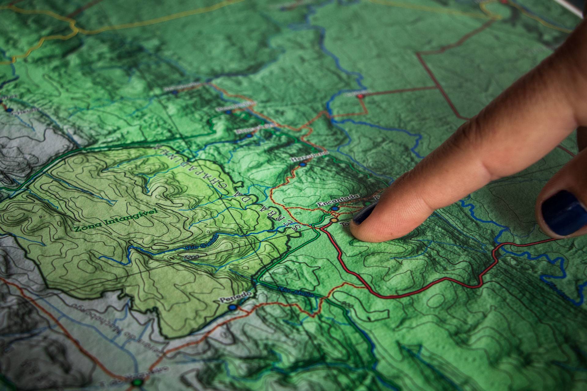
The protected area would cover a territory of about 18,000 hectares (44,500 acres) spread across three municipalities, the majority of which are in Itaetê, with two smaller sections in Mucugê and Ibicoara.
The Ibicoara city hall sent a motion of support for the protection of the mountain range, emphasizing the growing pressure from real estate and extractive industries in the region and calling the state government to action for the creation of the protected area.
The municipalities of Itaetê and Mucugê have not publicly commented on the proposal. The reporting team contacted both city halls, but received no response from either.
Mining advances
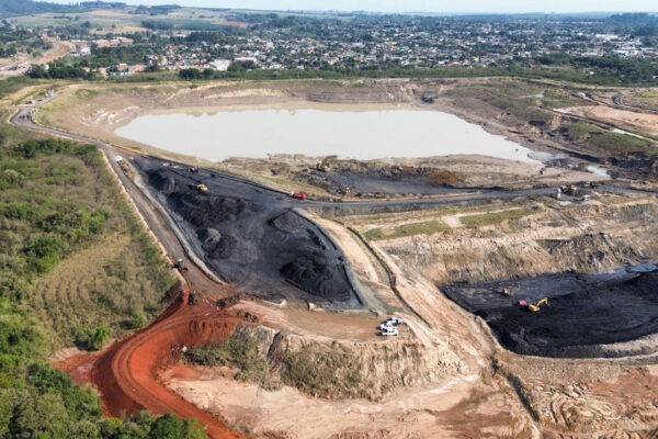
As the proposal to establish a protected area remains unrealized, the territory of Serra da Chapadinha continues to be vulnerable. One of the main parties interested in the “unprotection” of the region is the mining industry, which covers almost the entire mountain range with prospecting initiatives aimed at mineral extraction. In total, there are more than 14,000 hectares (34,600 acres) of areas authorized for prospecting in the region, according to open data from the National Mining Agency.
The majority of requests pertain to iron ore, but there’s also an interest in quartzite and diamonds, which were heavily exploited in the region in the past. The search for these precious stones is already underway and covers 149 hectares (368 acres) located on the edge of the range, near the entrance to the canyon leading to the Encantada waterfall. The area is close to the water source that supplies the Baixão settlement, where 160 families live. The prospecting process began in 2017 and has a permit valid until 2025.
During the prospecting phase, the company is authorized to make an initial exploration of the area — without commercial ends — to assess deposits and define the economic viability of extraction.
The greatest concern of residents is at the foot of the mountains, where iron ore is being prospected on the banks of the Timbozinho River, a tributary of the Una. The area, of 999 hectares (2,468 acres), is licensed to Mineração Novo Rumo Ltda.
“This activity [mining] has already shown too many traces of the destruction it leaves in the territories where it is established. It is an enterprise that endangers the environment, biodiversity, Indigenous peoples and traditional communities that make ancestral use of the territories so coveted by this type of high-impact exploration,” emphasizes Coelho.
Our team visited the site at the beginning of June accompanied by a resident who will not be identified for security reasons. We walked about 500 meters (1,640 feet) — just a part of the prospected area — along narrow trails that ascend and descend a forested hill, passing countless rocks of varied sizes. The largest are true colossi, while the smallest are the size of a car. Around some of them, trenches have been dug to reveal the buried part of the rock.
Much of the surface of the rocks not covered by dirt or vegetation shines and displays black veins, indicators of the presence of iron ore. Less than 100 meters (328 feet) separate the trail next to the rocks from the bed of the Timbozinho River.
“Now tell me, how are they going to remove all this without impacting the river? They’re going to devour this hill, they’ll take the forest along with it and it will all end up in the river,” says the resident.
In mid-April, after receiving reports of irregular iron extraction and deforestation, the Institute of Environment and Water Resources (Inema) conducted an inspection operation that resulted in a temporary suspension of activities. “But this action by Inema is still insufficient. The interdiction was made in only a quarter of the region,” says Coelho.
The reporting team reached out to Inema for more details about these activities, the irregularities found, whether the company was fined and whether mineral exploration has resumed, but received no response. Our team remains open for contact.
Mining company Novo Rumo is based in the municipality of Itaetê and was created in February 2023. The request to prospect the area was initially filed in 2017 and was passed around three different titular companies before being granted, in May of this year, to the newly established Novo Rumo Mining. One of the current partners in the company, Tree Stone Mining Ltd., is the former licensee of the area.
Its administrator, Daniel Rezende, actively carries mineral prospecting in two neighboring areas of 1,998 and 998.55 hectares (4,937 and 2,467 acres), also for iron ore. Both were initiated in 2022 and have permits valid until 2025.
The reporting team attempted to contact the phone numbers listed in the registration forms of Novo Rumo Mining and Tree Stone, but there was no no answer.
There is also a more recent process, filed on May 26 this year by the mining company Ubax Ltd., covering 827 hectares (2,043 acres) on both sides of the Una River. As of the publication of this story, authorization for mineral prospecting had not yet been granted.
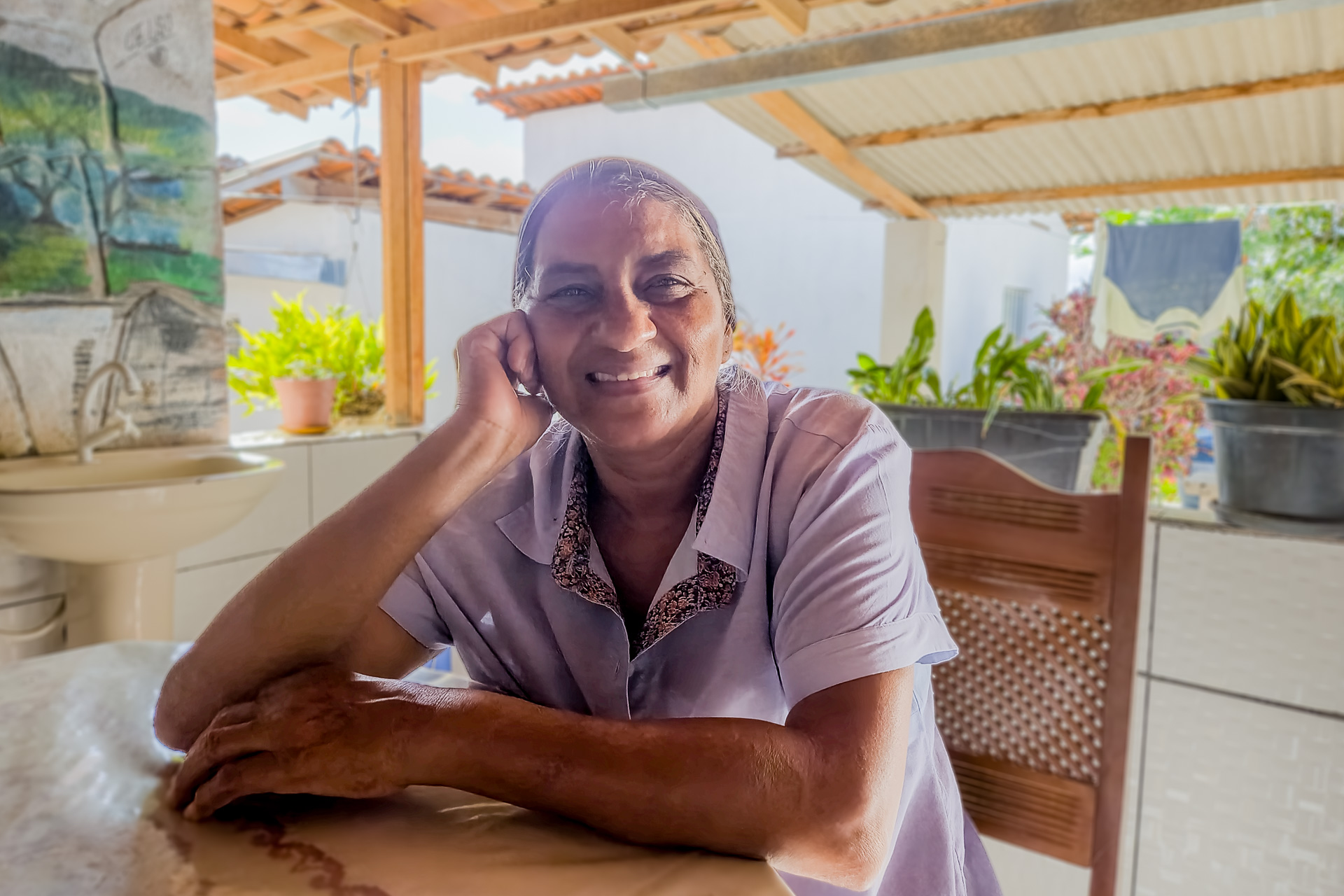
In the Colônia settlement, innkeeper Iolanda Santos is categorical. “The entire city is against it. [If mining takes place] it will ruin us, ruin the river, dry it up, bring diseases. I will do whatever I can to oppose it.”
Colônia is the oldest and largest settlement in the region, with 8,000 hectares (19,768 acres) and nearly 300 families. It is one of the closest to Serra da Chapadinha, along with Baixão, Valdete Correa and Europa. However, all nine settlements in Itaetê and the three Quilombola communities in the region depend on water coming from the mountain range.
“In socioenvironmental terms, more than a thousand families would be in a much more vulnerable situation,” emphasizes anthropologist Claudio Dorado from the Pastoral Land Council (CPT) of Bahia.
The CPT, the Movement for Popular Sovereignty in Mining (MAM), and the Observatory of Socio-Environmental Conflicts in Chapada Diamantina are leading the initiative to establish a conservation unit in Serra da Chapadinha. Together, these organizations are sending a letter to the Ministry of Environment and Climate Change about the importance of protecting the mountain range.
The CPT anthropologist warns that, in addition to environmental impacts, mining will impact the region’s economy. “There’s even a risk of land reconcentration because they [settlers] will no longer be able to survive in the area, and the mining company itself or some farmer will start speculating in the area and concentrating land,” he explains.
Serra da Chapadinha: beautiful and vulnerable
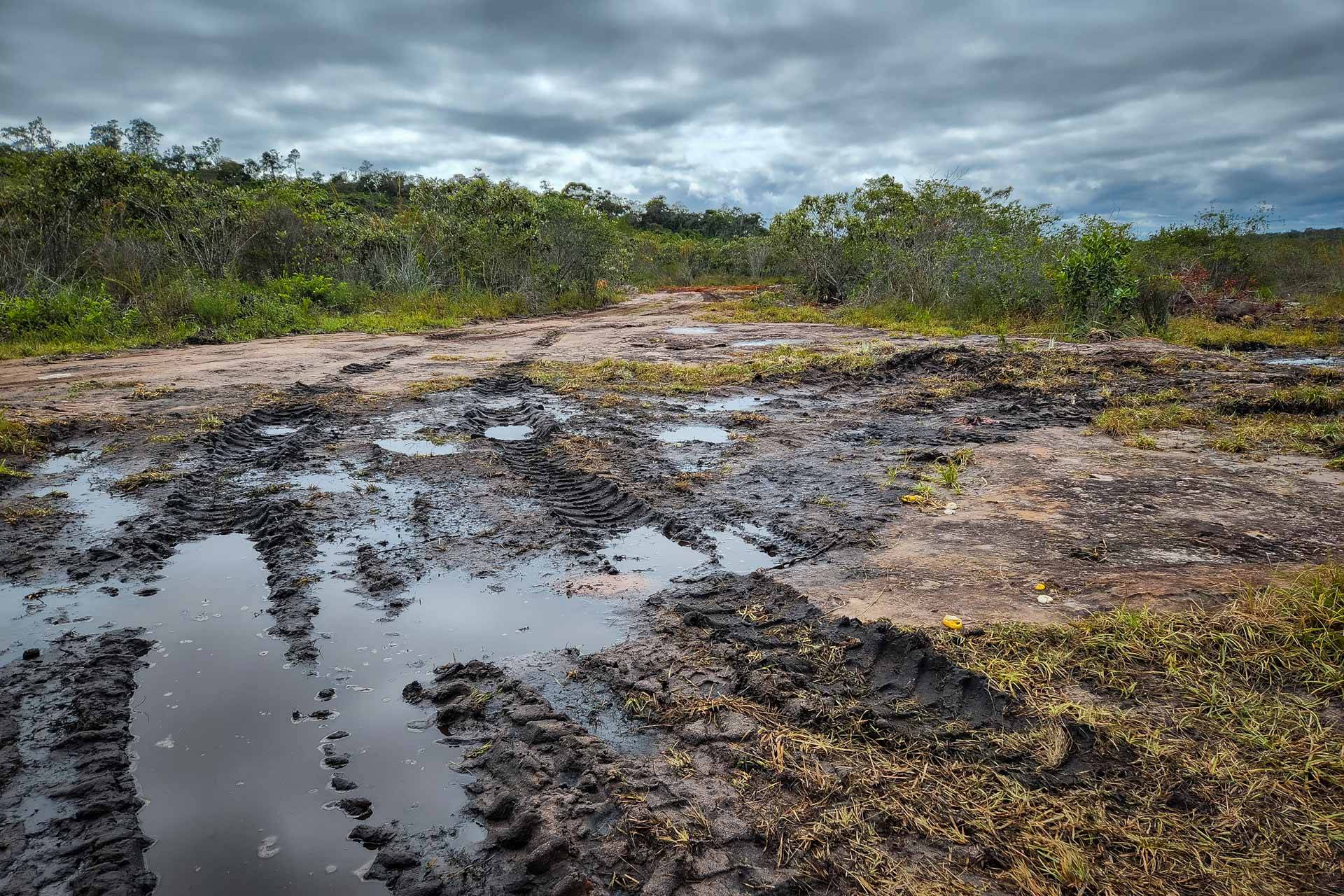
The reporting team from ((o))eco ventured into the field to explore Serra da Chapadinha. From the village of Rumo, a district of Itaetê, we weaved upward the mountains via a dirt road, our path alternating between red earth, rocky slabs, rivers and sandy areas.
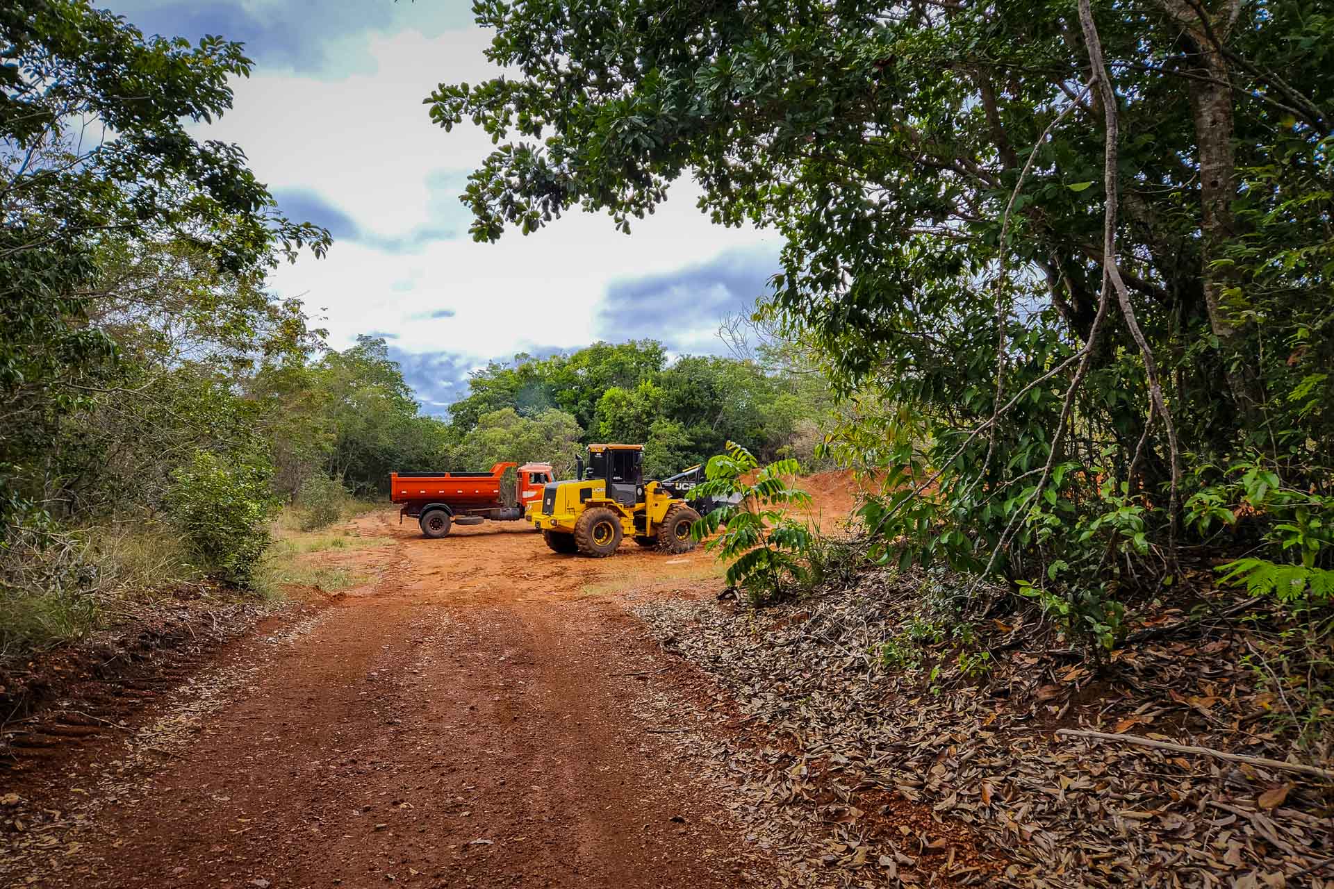
In one of the lower sections, we crossed a marshland turned into a mud pit by the wheels of tractors and trucks. “They’re widening the road,” our local guide, Sidney, informs us. “They’re improving access so the trucks can climb up and transport the timber.”
The territory of Chapada Diamantina is under special regulations by the Atlantic Forest Law, which, in theory, provides extra protection for vegetation and stricter rules for economic exploitation. Among the unique environments on the mountain range are the high-altitude wetlands, a singular and endangered ecosystem.
The area is rich in candeia (Eremanthus erythropappus), a tree that thrives in shallow soils. Its timber is heavily exploited to make fence posts, but the tree’s true value lies in the medicinal properties of the oil extracted from its bark, which is sold raw or distilled (into alpha-bisabolol, sold for around $90 per kilogram, or 2.2 pounds).
“They’ve been buying up everyone’s land. Almost everyone has sold. They’re going to take all the candeia,” Sidney warns, pointing to a dozen trees visible from the roadside.
On a Saturday, as we descended the mountain, we spotted machines at work on the road.
At another point, now at the foot of the mountain, we could hear the noise of a chainsaw in an area facing the “Fazenda Sossego da Chapadinha” sign belonging to the Citroflora company.
The company, established in 1997, is based in the municipality of Ituaçu, approximately 120 kilometers (75 miles) from Serra da Chapadinha. According to the records in the Brazilian corporate registry (Cadastro de Pessoa Jurídica), the company’s primary activity is the production of industrial additives. Secondary activities include the production of crude vegetable oils, logging and charcoal production in planted forests, and trade in timber and artifacts.
“The farm? It’s for sale,” Nivaldo Pamplona, managing partner of Citroflora, told ((o))eco over the phone when questioned about the property on Serra da Chapadinha. “There’s no activity there. We’re creating firebreaks because there are a lot of fires there, and we’re building access roads. We’re contributing to the road from the [village of] Rumo all the way up there,” he asserts.
To create firebreaks, he says some of the forest had to be cut down, “because it’s dense. You can’t make a firebreak 1 meter wide, it has to be 2 or 3 meters [6.5-10 feet], for access.” According to him, all was done with permission from the environmental agency. Inema did not respond to our inquiries about the property and the licensed activities in the mountains.
“It’s a region with lots of candeia, but it’s very complicated to work in, even in terms of labor,” laments the owner. “I’m finishing the work on the road and everyone is in shock, people don’t want development. There are so many denunciations, complications, difficulties in working,” he continues. He also adds that the farm, covering 203 hectares (500 acres), is the only property the company owns in the mountains.
When questioned, Nivaldo says he was unaware of the proposed conservation unit in Serra da Chapadinha.
Serra da Chapadinha, nice to meet you
During the uphill journey, one can see a few abandoned houses and farms. Currently, few people live in the higher part of the mountain range. One of the exceptions is the Toca do Lobo Inn, where a couple from São Paulo decided to start their life anew away from the hustle and bustle of big cities.
Alcione and Marco arrived at Chapadinha in 2007. After frequently hosting friends, they decided to open an inn. With four rooms available, they have become the only option for tourists wishing to explore the still-unknown beauties of this mountain range. The demand is still small. “Rarely do more than eight people come; usually we receive two, four,” Alcione comments.
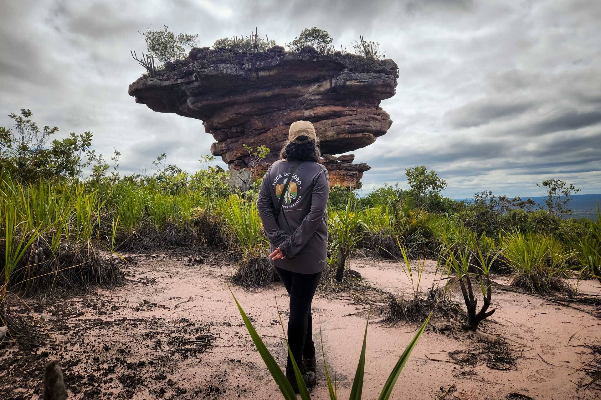
The couple took me to one of the local attractions, the Pedra do Caboclo. The enormous rock, carved by wind and rain, seems to defy gravity at the edge of the cliff. At the base of the stone, prehistoric paintings from an archaeological site still unstudied by the National Institute of Historical and Artistic Heritage (IPHAN) remain preserved.
The rock is located at the entrance to the canyon where the Samina River meanders, and it is possible to have a panoramic view of the region from there, as the wind that carved the stone toys with our hair.
“Over there is the Baixão settlement,” Alcione points out. “The water they use comes from up here,” he adds.
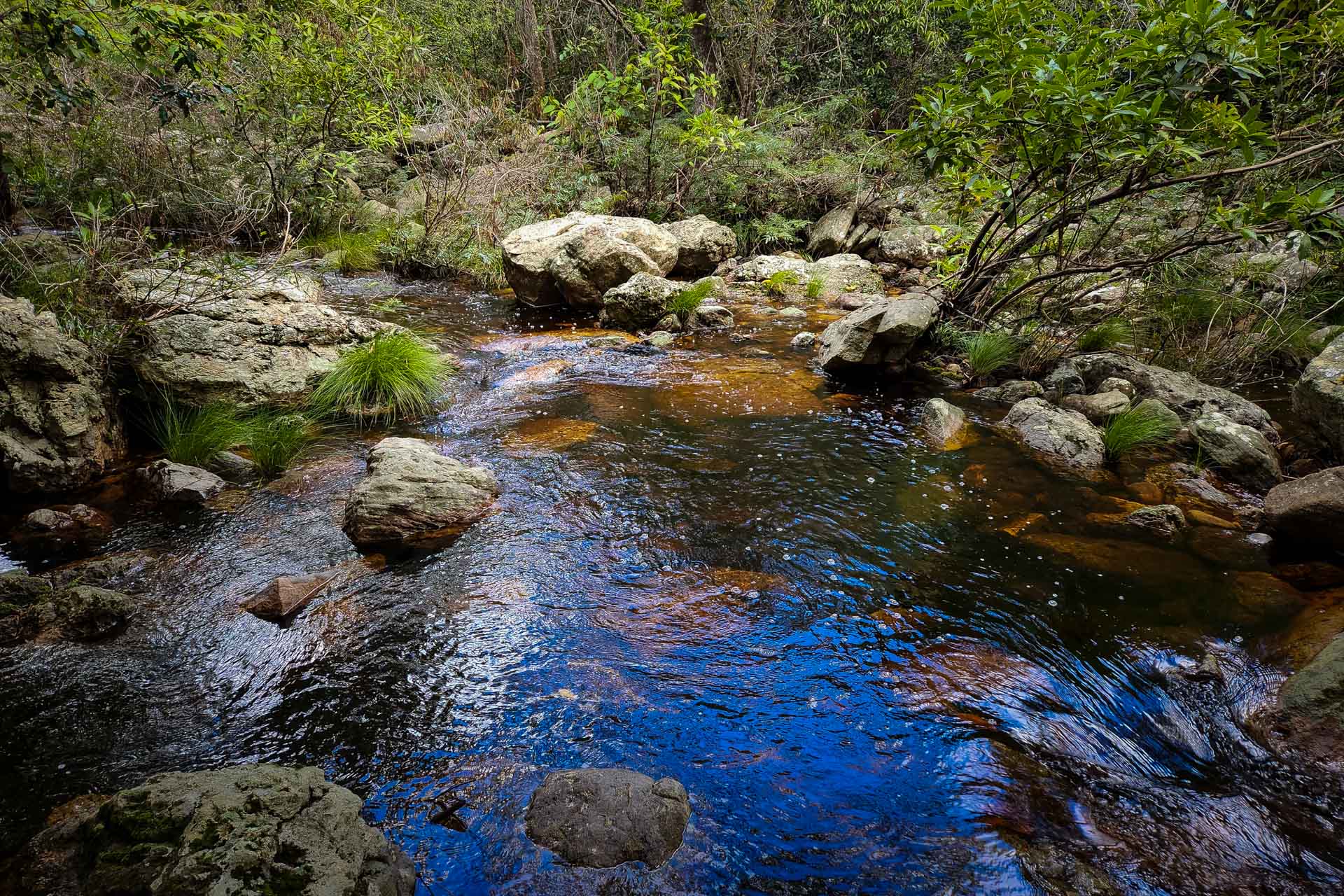
Chapada Diamantina, as a whole, is considered a large water reservoir, essential for Bahia. These waters, part of the Paraguaçu River Basin, supply the capital, Salvador, and the entire metropolitan region, covering more than 80 municipalities and 1.7 million people. Serra da Chapadinha also plays a crucial role in Bahia’s water security, housing rivers and springs that feed the Una River, the main tributary of the Paraguaçu.
“Serra da Chapadinha is one of the most crucial water recharge areas in Bahia. All this water doesn’t originate from dams or gray engineering structures. All the water we’re discussing is generated in the water recharge zones in the Chapada Diamantina, which still retain a naturally preserved condition to supply surface water bodies and underground aquifers,” asserts Coelho, who proposed the creation of the conservation unit.
Dorado, the anthropologist, mentions that the Chapadinha range has a cultural significance for the locals, who traditionally used the area for animal husbandry and farming during the dry season. Recently, however, these lands have been privatized and speculated, leading to a “land monopoly” and jeopardizing water as a common good, Dorado stresses.
“The vegetation of Serra da Chapadinha serves not to produce food, but to produce water. Only the traditional temporary management that was done can be carried out in that location,” he adds.
A home for threatened felines and monkeys
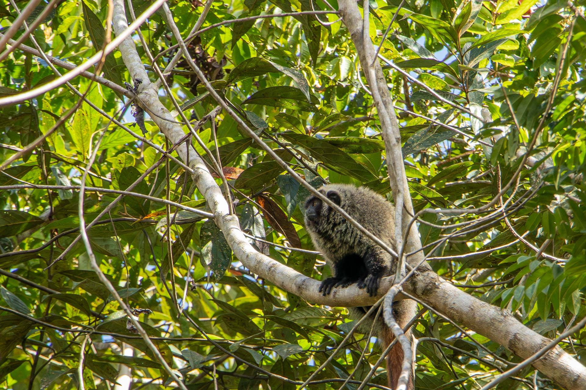
Serra da Chapadinha is a less-known, scarcely studied and seldom visited part of the Chapada Diamantina compared with the neighboring national park. Currently, its most frequent visitors are cougars (Puma concolor), brocket deer (Mazama gouazoubira) and white-lipped peccaries (Tayassu pecari). The fauna list also includes endangered species, such as the blond titi monkey (Callicebus barbarabrownae) and the buff-headed capuchin (Sapajus xanthosternos), both primates considered critically endangered.
The presence of four monkey species, two of which are considered threatened, has even led the National Research and Conservation Center of Brazilian Primates (CPB/ICMBio) to express, via an official letter accessible to the reporting team, their support for a protected area in Serra da Chapadinha.
Several of these sightings were made possible thanks to the initiative of a couple, the owners of the Toca do Lobo Inn. They decided to install camera traps to understand which species were circulating in the area.
“With just one camera, we’ve already recorded more than 25 species of terrestrial mammals, several of which are threatened,” shares Alcione. This includes four species of feline. Beyond the puma, the northern tiger cat (Leopardus tigrinus), a feline endangered in the country; the ocelot (Leopardus pardalis) and the jaguarundi (Herpailurus yagouaroundi).
The couple has also documented a species of lizard found only in the Chapada Diamantina (Acratosaura spinosa) and a species of freshwater jellyfish yet to be described by science.
“Serra da Chapadinha is a sanctuary for biodiversity,” Alcione emphasizes. This also includes rare species of flora, such as the paina-caboclo (Heterocoma erecta), endemic to the rocky fields of Bahia and classified as endangered.
The flora, in fact, is something that stands out in the Chapada. On the mountain trails, countless flowers color the landscape, enchanting its visitors. As the name Cachoeira Encantada — Enchanted Waterfall — already announces, the region is designed to delight, and more and more people are discovering the charms of Serra da Chapadinha.
“Up until four years ago, I guided people once, maybe twice a year. These days, when it’s slow, I guide three times a month,” says Sidney, better known as Tarzan, who works in Serra da Chapadinha. According to him, the word is slowly spreading, and more tourists have been coming.
The activity is still modest, especially compared with the flow in the neighboring national park, but it represents an economic alternative and a tool for valuing the heritage that is Serra da Chapadinha. For this, however, it is necessary to protect the nature that finds refuge there.
-

Duda Menegassi
Jornalista ambiental especializada em unidades de conservação, montanhismo e divulgação científica. →
Se o que você acabou de ler foi útil para você, considere apoiar
Produzir jornalismo independente exige tempo, investigação e dedicação — e queremos que esse trabalho continue aberto e acessível para todo mundo.
Por isso criamos a Campanha de Membros: uma forma de leitores que acreditam no nosso trabalho ajudarem a sustentá-lo.
Seu apoio financia novas reportagens, fortalece nossa independência e permite que continuemos publicando informação de interesse público.
Escolha abaixo o valor do seu apoio e faça parte dessa iniciativa.
Leia também

Caminhoneiros autônomos reclamam de dificuldade na aquisição de veículos menos poluentes
Relatos mostram que em três anos de vigência do Proconve P8, Brasil não avançou para transição energética justa no transporte rodoviário de carga →
Novo centro no RJ vira marco para restauração da Mata Atlântica
O centro será um espaço de pesquisa, capacitação e um amplificador de boas práticas na recuperação do bioma, promovido pela Associação Mico-Leão-Dourado →
Enchentes podem espalhar poluentes da mineração de carvão no Rio Grande do Sul
Metais tóxicos e outros contaminantes associados à extração de carvão podem ser transportados por chuvas intensas e enchentes, alcançando áreas distantes das minas →